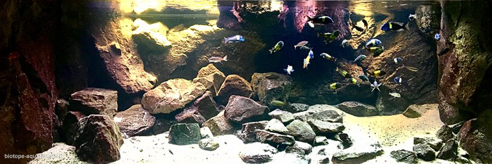
Where the sand meets the rocks in lake Tanganyika
87th place in Biotope Aquarium Design Contest 2017
![]() Denmark. Jacob Kjærggard-Taustrup
Denmark. Jacob Kjærggard-Taustrup
Volume: 1120 L
Dimensions: 200x80x70 cm
List of fishes: 5 Julichromis Transcriptus, 4 Neolamprologus Leleupi( orange), 5 Eretmodus Cyanostictus “ Blue Spot”, 3 Callochromis macrops, 13 Tropheus Duboisi Maswa 9 F1 and 4 F2, 16, Tropheus Ikola Kaiser F1, 2 Gnatochromis permaxillaris.
List of plants: N/A
Description of decorations: The rocks are collected from mountains in Tenerife( Spain) Rhodos(Greece) Italy, Gran Canary( Spain) and Denmark( Bornholm). The sand I collected is by collected by beaches in Denmark and in Italy( Liguria) in 6 different sizes fro 2-10 mm to give a more naturally look. Furthermore The Background and the rocks in the surface in the Aquarium is build up with 12 Back to Nature modules.
Description of equipment: Under the Aquarium I have 250 ltr sump whith 4 rooms and 3 filter materials driven by a pump Aquabee up 2001, In the Aquarim there is a Tunze circulation pump. The light I use is T8 with Red light ( Grolux) (2×36 W) and 4 T8 Sylvana Aquastar with blue/white light.( 36 W)
Water parameters: The ph is 7,5 and the temperature is 26,3 celcius.
Description of the area surrounding the biotope: Tanganyika waters lap Tanzania, Burundi, DR Congo and Zambia. Lake Tanganyika is situated within the Albertine Rift, the western branch of the East African Rift, and is confined by the mountainous walls of the valley. It is thelargest rift lake in Africa and the second largest lake by volume in the world. It is the deepest lake in Africa and holds the greatest volume of fresh water, accounting for 16% of the world’s available fresh water. It extends for 676 km in a general north-south direction .
The lake covers 32,900 km2 with a shoreline of 1,828 km, a mean depth of 570 m and a maximum depth of 1,470 m in the northern basin. It holds an estimated 18,900 cubic kilometres. The catchment area of the lake is 231,000 km2. Two main rivers flow into the lake, as well as numerous smaller rivers and streams (whose lengths are limited by the steep mountains around the lake). There is one major outflow, the Lukuga River, which empties into the Congo River drainage. The major river flowing into the lake is the Ruzizi River, formed about 10,000 years ago, which enters the north of the lake from Lake Kivu. The Malagarasi River, which is Tanzania’s second largest river, enters the east side of Lake Tanganyika. The Malagarasi is older than LakeTanganyika and, before the lake was formed, directly drained into the Congo River.
Description of the underwater landscape of the biotope: The sand meets the rocks which gives space for several species. The rocks are algae green and covered with sand which gives good terms for Tropheus and Eretmodus and Callochromis Macrops.
Description of the parameters of the habitat: The lake‘s water is alkaline with a pH of around 9 at depths of 0–100 m (0–330 ft).[ Below this it is around 8.7, gradually decreasing to 8.3—8.5 in the deepest parts of Tanganyika. Surface temperatures generally range from about 24 °C in the southern part of the lake in early August to 28–29 °C. In the late rainy season in March—April at depths greater than 400 m the temperature is very stable at 23.1–23.4 °C
List of fishes: Julichromis Transcriptus, Neolamprologus Leleupi( orange), Eretmodus Cyanostictus “ Blue Spot”, Callochromis macrops, Tropheus Duboisi Maswa, Tropheus Ikola Kaiser
List of plants: N/A
Threats to the ecology: But despite being a world class reservoir of biodiversity, food and economic activity, the lake is changing rapidly and may be facing a turbulent future. Lake Tanganyika was recently declared the “Threatened Lake of 2017″ — adversely affected by human activity in the form of climate change, deforestation, overfishing and hydrocarbon exploitation
Sources of information: Back to nature Tanganyika by Ad Konings, Wikipedia