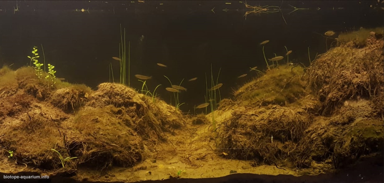
Flooded area in El Culebrón wetland, protected area in Coquimbo, Chile
71st place in Biotope Aquarium Design Contest 2018
![]() Chile. Esteban Yáñez Valdivia
Chile. Esteban Yáñez Valdivia
Volume: 121 L
Dimensions: 100x40x30 cm
List of fishes: Australoheros facetus (introduced), Cnesterodon decemmaculatus (introduced), Gambusia holbrooki (introduced)
List of plants: Eleocharis macrostachya
Description of decorations: The substrate corresponds to clay characteristics that is practically impermeable. However, there are plants that can break the surface, as shown in the photograph. The substrate is carefully removed from the same place to be represented, strategically placed in the aquarium so that the areas are not easily lifted by the inhabitants of the aquarium. We found a lot of roots that are placed in the contours of the mounds described to generate some hiding places for the small crayfish that live in the aquarium.
Description of equipment: Boyu SP-603E submersible filter, 100W 6500K yellow LED light, Boyu thermometer.
Water parameters: Constant temperature is 17°C.
INFORMATION ABOUT BIOTOPE
Description of the area surrounding the biotope: The geographic position of Coquimbo is 29°57’00″S 71°20’00″W, in the northern center of Chile, South America. Its height above sea level is 15 meters with a temperature that remains around 18°C, with minimum of 14°C and maximum of23°C. The wetland starts in the mountainous zone of the mountain range of the coast in the region of Coquimbo. El Culebrón is located in the city of Coquimbo within the political and administrative division in the commune and region with the same name. Geographically it is located specifically in the south-west end of the bay with the same name and was part of a humid ecosystem existing along the entire coastal length of the bay, which in favor of the progress of the cities of Coquimbo and La Serena, was drained during the fifties with the construction of civil works (drains) that drained these areas and allowed to populate and build houses in these places. The estuary corresponds to the main natural surface water flow of the Pan de Azúcar micro-basin and empties into the Pacific Ocean in the Changa Beach sector. The basin is of the exorheic pre-Andes type with rainfall regime. Its main use is agriculture. Its average flow is 0.38 m³/s and it receives natural contributions from a series of streams within the basin and artificially receives irrigation surpluses from the Bellavista Channel. The latter leads waters from the Elqui River to the sector of Pan de Azúcar. In its lower part a coastal estuarine wetland with a main lagoon of an approximate surface of 14,764 m² is formed, which does not have a terminal bar, so the marine influence is constant and determines the ecological functioning of the lagoon.
Description of the underwater landscape of the biotope: The area represented corresponds to an area adjacent to the wetland that from June to September goes underwater. Small mounds are formed due to the sediments that are crumbling in the terrestrial zone with the entrance of the water. In these mounds, an interesting plant life develops corresponding to some lichens and Eleocharis macrostachya. The area is characterized by almost no presence of stones, on the contrary, the softness of the land is a unique feature of the area.
Description of the parameters of the habitat: (Average) temperature is 17.3°C. PH is 8.77. Conductivity is 0.97. Transparency is 2 meters. Current speed is 0.26 mps.
List of fishes and invertebrates occurring in the nature biotope: Cyprinus carpio (introduced), Mugil cephalus (vulnerable), Cichlasoma facetum (introduced), Cnesterodon decemmaculatus (introduced), Gambusia holbrooki (introduced), Cheirodon pisciculus, Tetra chileno (vulnerable), Cherax tenuimanus (invertebrate).
List of plants found in the nature biotope: Eleocharis macrostachya.
Threats to the ecology: It is one of the most threatened areas of the Coquimbo region due to the irresponsible action of man. Currently, the municipality of Coquimbo has taken action in the matter declaring the wetland as a protected area, generating various activities to promote care and respect for the environment in the area. However, the protected area is really small compared to the actual size of this tributary. The populated areas use this beautiful estuary as a real illegal dump, generating garbage hills that end up affecting nature. In this work, I try to recover the best of this beautiful area that is being depredated in an extremely irresponsible way, so in a few years, we will not be able to see this beautiful place anymore.
Sources of information:
http://bdrnap.mma.gob.cl/recursos/SINIA/Biblio%20SP-64/070316BIBLIORNAP_049.pdf
www.mma.gob.cl/…tercer…/Cheirodon_pisciculus_PO3R2_RCE_CORREGIDO.doc
repositorio.uchile.cl/handle/2250/143796?show=full
documentos.dga.cl/MED4720.pdf
Ministerio de Medio Ambiente de Chile.
Sernapesca Chile
Comments of the members of the jury of Biotope Aquarium Design Contest 2018

When I look at this entry, I have a feeling as if someone have cut out a piece of wildlife and placed it in an aquarium. Very realistic. Thanks to the author! It feels like I myself had been in this biotope with an underwater mask.